|
<<< Home
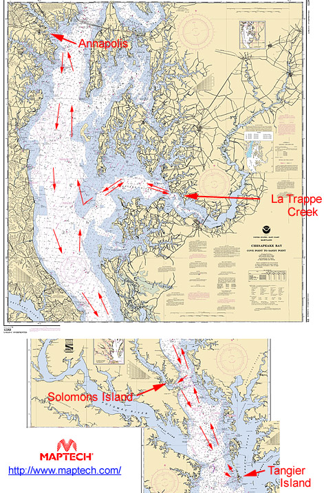
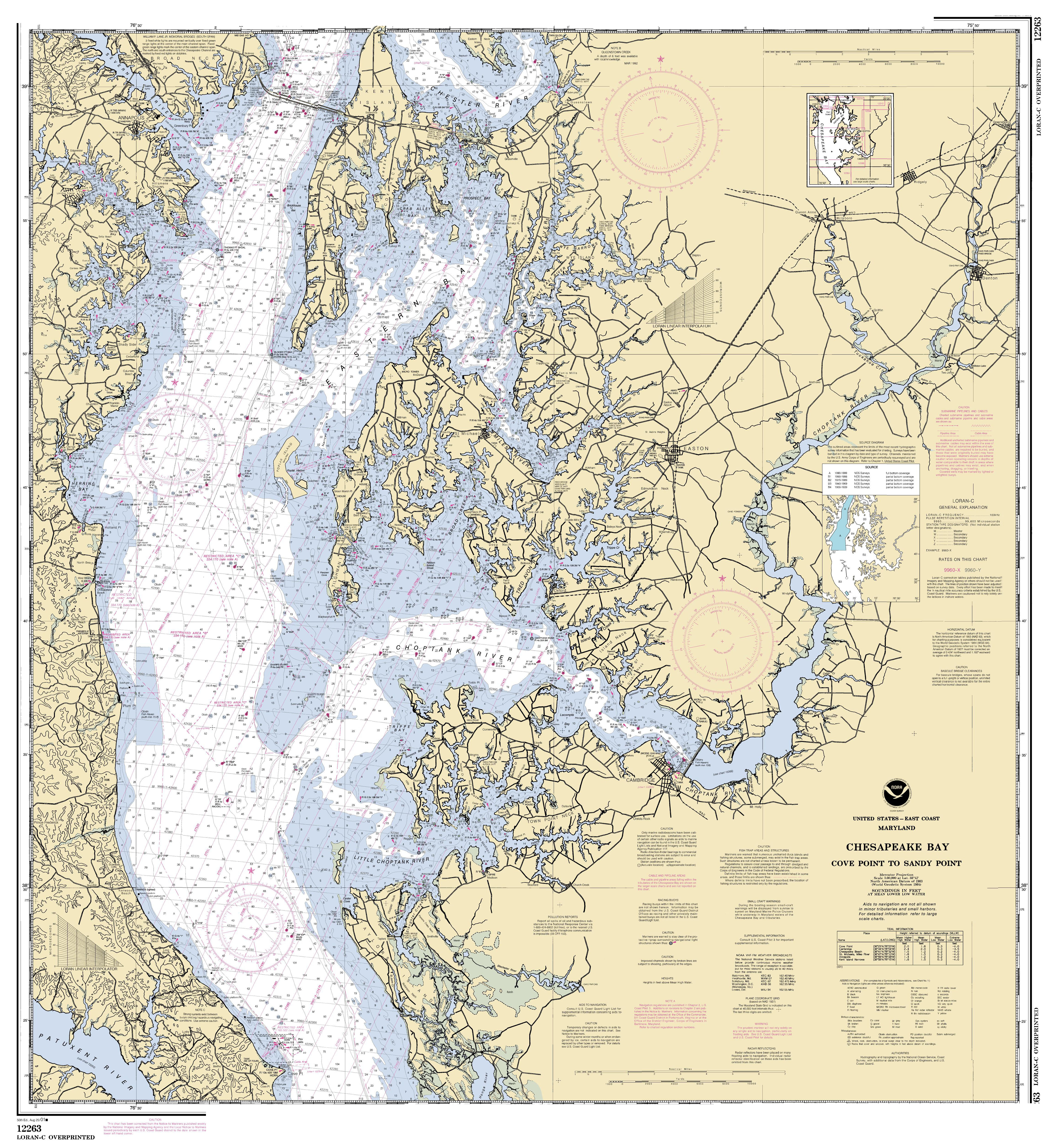
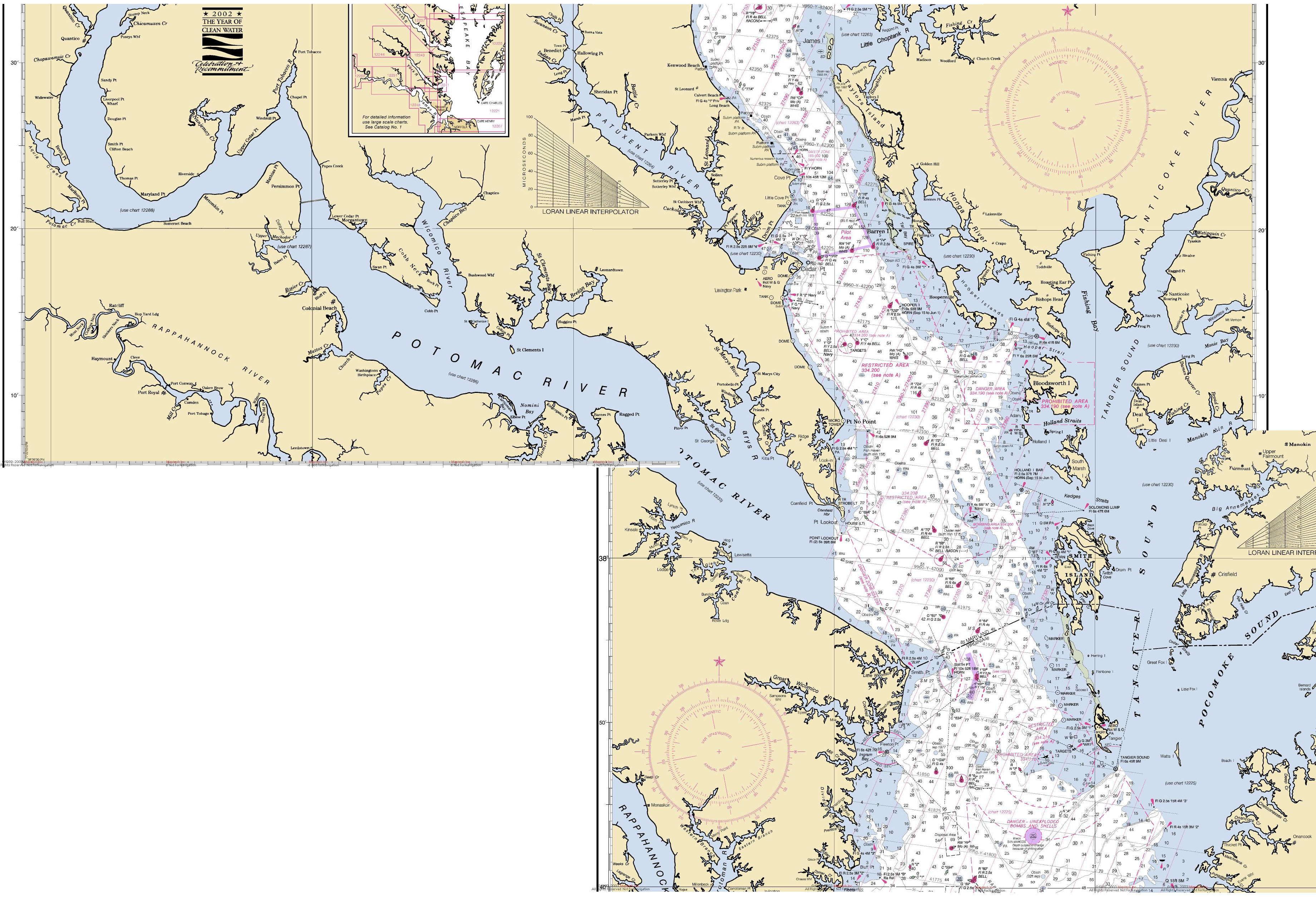
<< Bahia < Independence Sail photo galleries: part one | part two | part three Additional information: Solomons Business Association solomons-island.com Tangier Island Guide Delmarva Online: Tangier Island Oxford Yacht Agency: La Trappe Creek riverheritage.org: Trappe Landing Want the full-size charts? Upper (Annapolis to Cove Point) Warning: 5.48 MB Lower (Little Choptank to Pungoteague Creek) Warning: 1.51 MB Additional note: Charts are of different scales |