

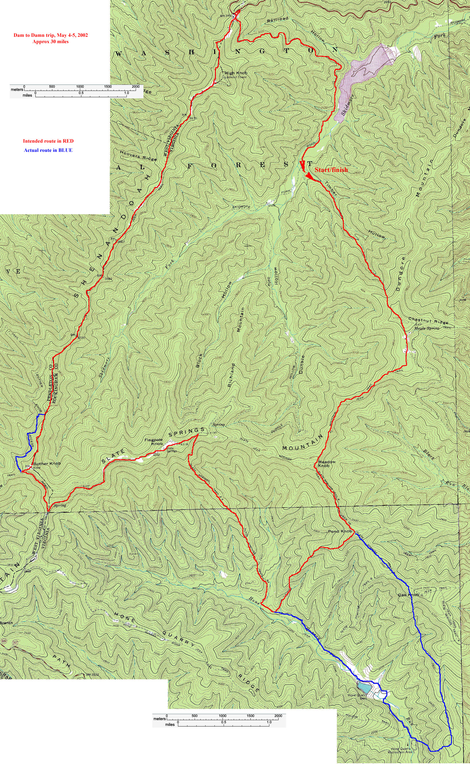
Map |

3D view, looking north-northwest |

Overview, Harrisonburg to trailhead |
post-hike update: we extended the trail somewhat, making it about 30 miles. Here's a small version (467 k) of the route details and here's a gigantic version.(3.28 MB). 
tjd's pics have finally found a home |