|
The plan for this day was to do a short drive to Matagami, less than 200 miles away. Since there was less driving than usual, we had plenty of time to stop to smell the frozen roses. We had breakfast at the same place we ate dinner. Mickey sneaked off to another room and e-mailed the remaining photos to Ho. While he did that, we packed our stuff, unplugged and loaded up the vehicles - they all started fine due to the block heaters. Michel and I went across the street to the Wal-Mart to get a longer cord for Mick and marking pens for myself. We came back and Mick was nowhere to be found. Everyone was asking where he was, since all his stuff was still in the room, all over the place.
Everyone was ready to go, but Mick was AWOL. He eventually turned up, explained the situation, got his things in the truck and we were off. It was a brisk morning, about -25°C, and we hit the road in bright, bright sunshine. It was blinding to be without sunglasses of some sort: the sun was low and reflected off the snow in every direction.
We weren't in the vehicles for long when we spotted a snow sculpture exhibit near the river. Finding parking spots nearby, we got out and took photos of all of them. Some were quite elaborate, others simple, but all were expertly crafted. Once we were finished ogling, we got back into the Rovers: there was much left to do today. We discussed over the CBs about getting our NATO jerry cans filled: from this point on, gas stations, while present, are unreliable. The location decided upon was Amos, a small village less than halfway up the day's route. There we would also have lunch, but not before another stop at one of the last (if not the last) Tim Hortons until we return to some semblance of civilization. Of course, this offered us another opportunity to practice our French, words like "Crème Boston" and "beignets," etc. I have just now discovered that Tim Hortons is owned by Wendy's, which makes me wonder why these restaurants aren't south of the border. Maybe Dunkin' Donuts is too big a competitor. Who cares, really, anyway?
Apparently, it's been a pretty dry year here, even though "dry" consists of a foot or more of standing snow, and snowplow-created piles up to 12 feet. In D.C., it rarely snows a foot total in a season, and it's even more rare to see a foot fall at one time on the nation's capital. When it does snow here, everything comes to a standstill, but not before everyone panicks and buys all the bread and toilet paper they can find. Curiously, too, is that when snow merely threatens, there's a run on snow shovels, of which apparently there are not enough to supply the demand. The network and local news programs run stories on this, every single time.
We arrived in Amos before noon and went into the first gas station we saw. All three vehicles needed their internal and external tanks filled. Mick unstrapped the jerry cans and handed them down to me to give to the attendant to fill. I then handed up the full cans to Mick,
Again we went only a short distance before parking at a "sight:" the Cathédrale Ste-Thérèse D'Avila, a large church which we suspected was the center of Catholic activity from here to Baffin Island, over one thousand miles to the north (above the Arctic Circle). We looked at the outside for a while before going in to see and take more photos. Mary and Ted lit a candle for a friend. I went back out to see the outside at other angles before meeting up with the rest of the group to hit the road once more.
Somewhere along the way, it was lamented that we weren't really off-roading on this trip, just
By dark, we finally pulled into Matagami, and it was getting noticably colder. Like astronauts exploring the moon, we drove about the town in our own little controlled-atmosphere vehicles, the silence interrupted by the crackling of the CBs and the comments coming through: "We're taking a left here...," "I think that's a good place over there," and so on. For Mickey and me, it seemed even more like foreign territory because we had blinders in the form of frozen condensation on all the windows save the windshield. We couldn't see much except for what lay directly ahead of us.
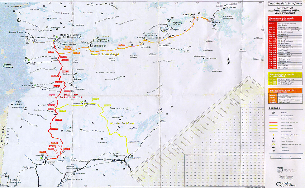
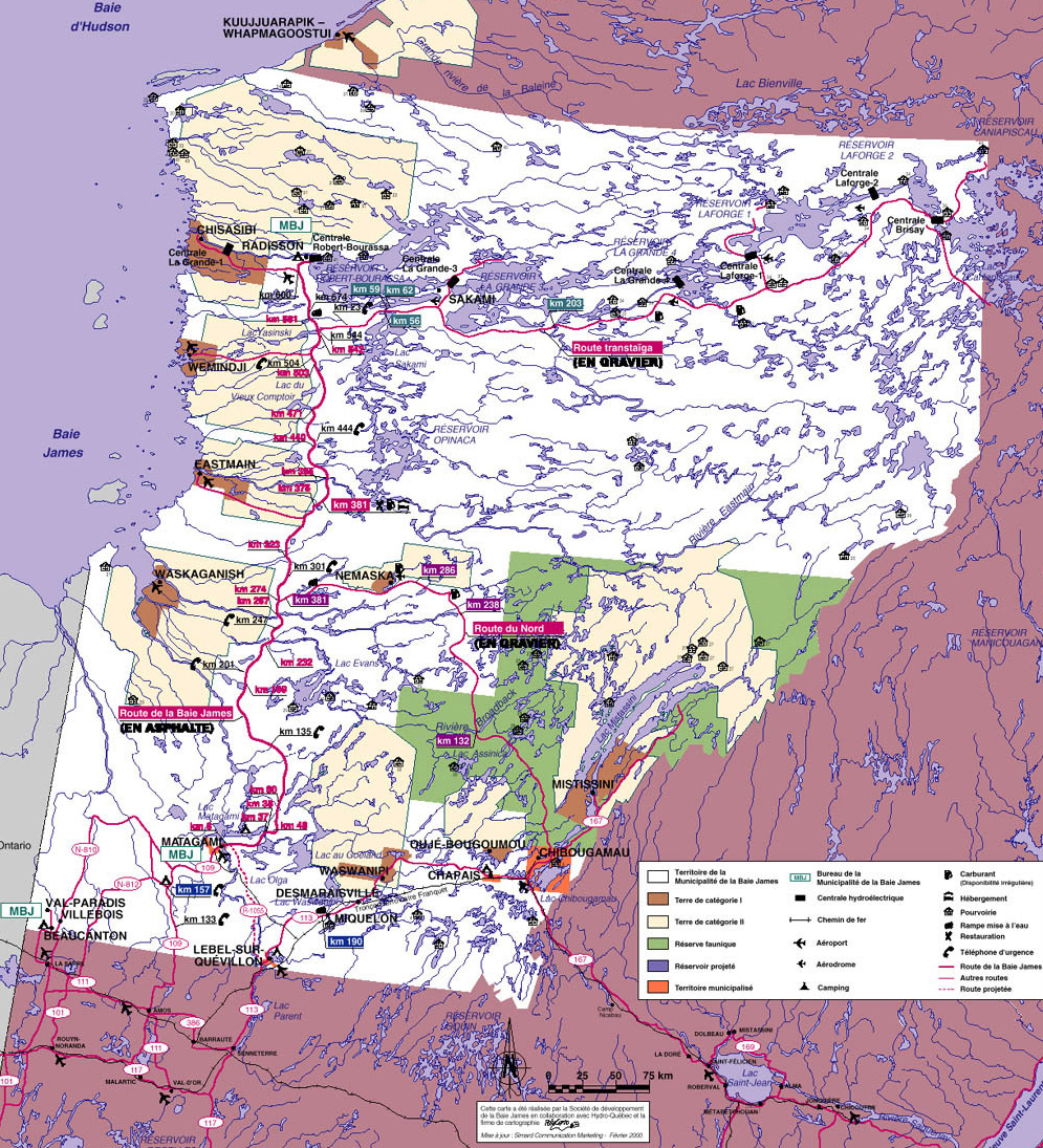
We picked the Hotel Matagami, but it looked kind of crowded. We saw a sign advertising a rock-and-roll show in the club, but we didn't think it would be too disruptive. We checked in and were shown the dining room adjacent to the club. It was quite loud, and we couldn't hear ourselves think. We got a bit of dinner in us, and Mickey took a map of the area from the back of the menu. This map, which I scanned in here (warning - image size: 368K), known as the "menu map," was to prove useful later on in the trip because it had latitude and longitude lines, which the official James Bay area map (warning - image size: 768K) does not. After eating, we did what was becoming the normal evening routine: plug in, bring valuables into the rooms, break out the whisky and port, look at and web-prep the photos, write, edit and e-mail the commentary for the day with the accompanying photos, then drink and talk until everyone's ready to pass out. We knew we had a long day ahead this time, so we went to sleep a little bit earlier. |

|

|
|
Author: 
|
| Last updated: April 16, 2001 © tjd |


